"You can give without loving, but you can never love without giving."
Robert Louis Stevenson
Friday, March 31, 2006
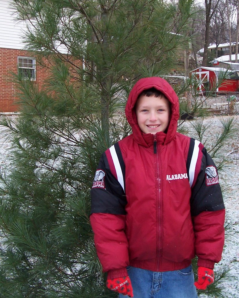
Bama Basketball 2005-2006
Earlier this year I gave an update on the status of the Alabama Crimson Tide 2005-2006 basketball team's season. Well the season is over for the Tide, and it was a good news/bad news type of season. The good: Alabama made the NCAA tournament for the fifth season in a row. After struggling at times in the pre-conference schedule, the Tide had several big wins. On January 14, they defeated Kentucky in Lexington. On February 4, they defeated NCAA final four member LSU in Tuscaloosa. On February 26, they defeated another NCAA final four member, Florida, in Tuscaloosa. They defeated higher seed Marquette in the first round of the NCAA tournament and came within a basket of defeating elite 8 member UCLA to reach the sweet 16. They did all of this thanks to the emergence of several youngsters, including three freshmen, Dewayne Hendrix, Alonso Gee, and Brandon Hollinger. The bad: Alabama lost senior forward Chuck Davis to a knee injury that ended his college career. That injury, along with the defection of guard Justin Jonus, left the team short-handed with only seven available players. Once again, Alabama failed to take the next step and advance to the final four. They also failed to win twenty games. All-in-all, as a fan, I can't complain. If this represents a "down year"
for the Tide, or a re-building year, the future still looks bright with Coach Mark Gottfried at the helm.
for the Tide, or a re-building year, the future still looks bright with Coach Mark Gottfried at the helm.
Baseball Season
The 2006 Major League Baseball season is upon us. The first game of the year is on ESPN this Sunday night. The official opening day is Monday, when President Bush throws out the first pitch at the Great American Ball Park in Cincinnati. This year will be interesting, and as usual, there are multiple sub-plots as well as surprises in store. Some things to look for include: Will the Bobby Cox and the Braves add to their professional sports record and win their 15th consecutive division title? Will the Red Sox or the White Sox win it all again, or will they wait another 90 years or so? What about the Cubbies? Will they reverse their curse like the White Sox and Red Sox have the past few years? Did I just here a goat say, "Nah!"? Can the Yankees, Mets, or Dodgers spend their way into the World Series this year? Will Barry Bonds set a new home run record, passing Babe Ruth and Hank Aaron, or will he be indicted? Will Rocketman Roger Clemens play this year, and if so, for whom? Will Alex Rodriguez, Albert Pujols, and Andruw Jones continue to put up staggering numbers? Will Greg Maddux win 15 games and break the record for most gold gloves? I could go on and on. One of the great things about MLB is keeping up with statistics, which provides the basis for Fantasy Baseball. Again this year, my friends Johnny, Rob, and Tom will be joined by my sons David, Joe, and I in the Blue-Gray League. Will second-year manager Joe lead Joe's Braves to another title or will he suffer the proverbial sophomore jinx? Can the Mesocyclones take the next step and win it all? Don't forget Rob's Redbirds. They always finish strong and have won several titles in the past. Can the San Juan Roughriders maintain their typical fast start and cruise to the pennant, or will they wilt like a flower in the heat of September as usual? Never count out David's Cubs or the Bama Tide. Well, if you go by the name "Cubs" you might want to go ahead count out David's Cubs! Sorry son! I'm looking for lots of fun and intrigue this season. Play ball! Go Atlanta Braves and Go Mike's Mesocyclones!
Thursday, March 30, 2006
Baseball Practice
Baseball practice began for the boys on March 16. With three boys playing baseball, that keeps us busy from March through June. Matt has moved up from Tee Ball to "Coach Pitch" for seven and eight year olds. He is one of the younger players on his team but he is probably one of the best. Yes, I know I'm partial, but I really think he is. The coach has him playing first base because he is good at catching the ball. I think one reason Matt is so good is that he practices with his two older brothers so much. I am a firm believer that being challenged by playing with others at a higher level makes a huge difference. Joe is in his second year in the 9-10 age group. He has improved a lot the last few years. He missed out on tee ball so he has some catching up to do when he started at age 7. It has amazed me at how much stronger he has gotten since last year. I was throwing batting practice one day this winter and he almost nailed me with a line drive. He can also throw much harder than he did this time last year. David is in his second year in the 11-12 age group. David really came on strong at the end of the season last year. In his last game at Cold Springs he got 4 hits, all of which were line drives. One thing that has helped David was taking him to the batting cages. He likes to get in the 70 mile per hour cage. That makes the pitchers in his league seem slow by comparison. This past Tuesday, David's coach, who does a terrific job, by the way, took the team to the batting cages. David was in the 50-60 mph cage and had three rounds of 16 swings. He made contact 15 out of 16 times in the first two rounds and hit 12 out of 16 in his third round. The main thing is that they all enjoy playing. They have a lot of fun and learn a lot of important values about teamwork. I'm so glad that they all have so much fun. That's what it's all about!
Wednesday, March 29, 2006
Is Winter Weather Really Over?
I think the answer is "yes" to that question. But, in case you missed it, Old Man Winter saved one more blow for Tennessee last weekend. Check out this interesting entry from "Weather Talk"!
Tuesday, March 28, 2006
Death of Hee Haw Star Buck Owens
No, I don't come from a redneck family, by any means; but we watched Hee Haw and Lawrence Welk every Saturday night as I grew up. It was sad to hear of Buck's death today. I always enjoyed his "rockabilly" style of music.
Weather Talk Blog
Readers may have noticed one of my links here is to the ABC 33/40 Weather Talk blog. If you have even a casual interest in weather I highly recommend this site. It's very educational, informative, thought provoking. These self-professed "weather geeks" are so much more than that! My favorite entry was "Waiting Too Late" by Bill Murray on August 27, 2005 at 10:45, before Hurricane Katrina made landfall on the Gulf Coast. I wish every citizen of this country could see this post.
Monday, March 27, 2006
AARP Article on Paul McCartney
There is a really nice article in the May-June 2006 issue of AARP Magazine. The article reminds us that in June of this year, the composer of the song "When I'm 64" turns 64 on June 18, 2006. According to the article, "So, as he approaches 64, Sir Paul is hardly "wasting away," as his song so pessimistically predicted. If anything, he's experiencing vital reinvention and growth—but not without having been served his share of sorrow and doubt along the way."
Read the entire article and special features here.
Read the entire article and special features here.
Illegal Immigration
I have a hard time understanding how we as a nation have fallen into controversy over illegal immigration. According to Webster's, "illegal" is defined as "not according to or authorized by law : UNLAWFUL, ILLICIT; also : not sanctioned by official rules."
I do understand that we can have a debate about what we want our immigration laws to be and we can argue about the best ways to enforce those laws. But why are we debating whether illegal immigrants have the same rights as citizens?
We need to either enforce the laws we have or make citizenship easier. But, please, let's not pretend that illegal activity is worthy of reward.
Friday, March 24, 2006
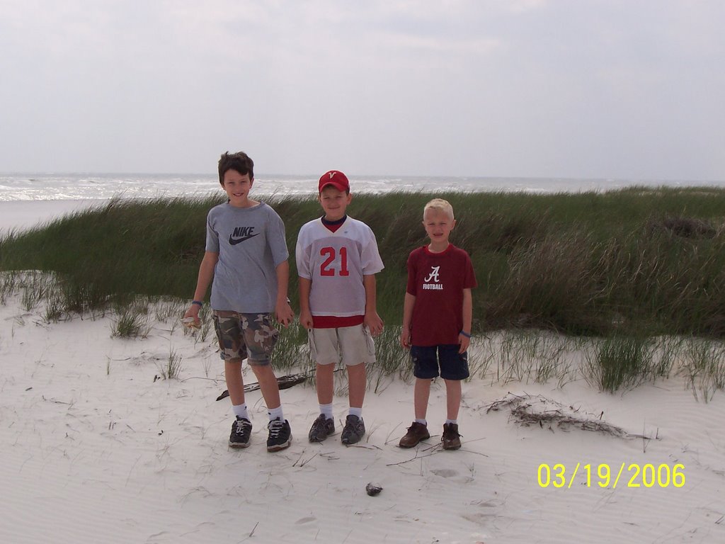
Spring Break Photos 2
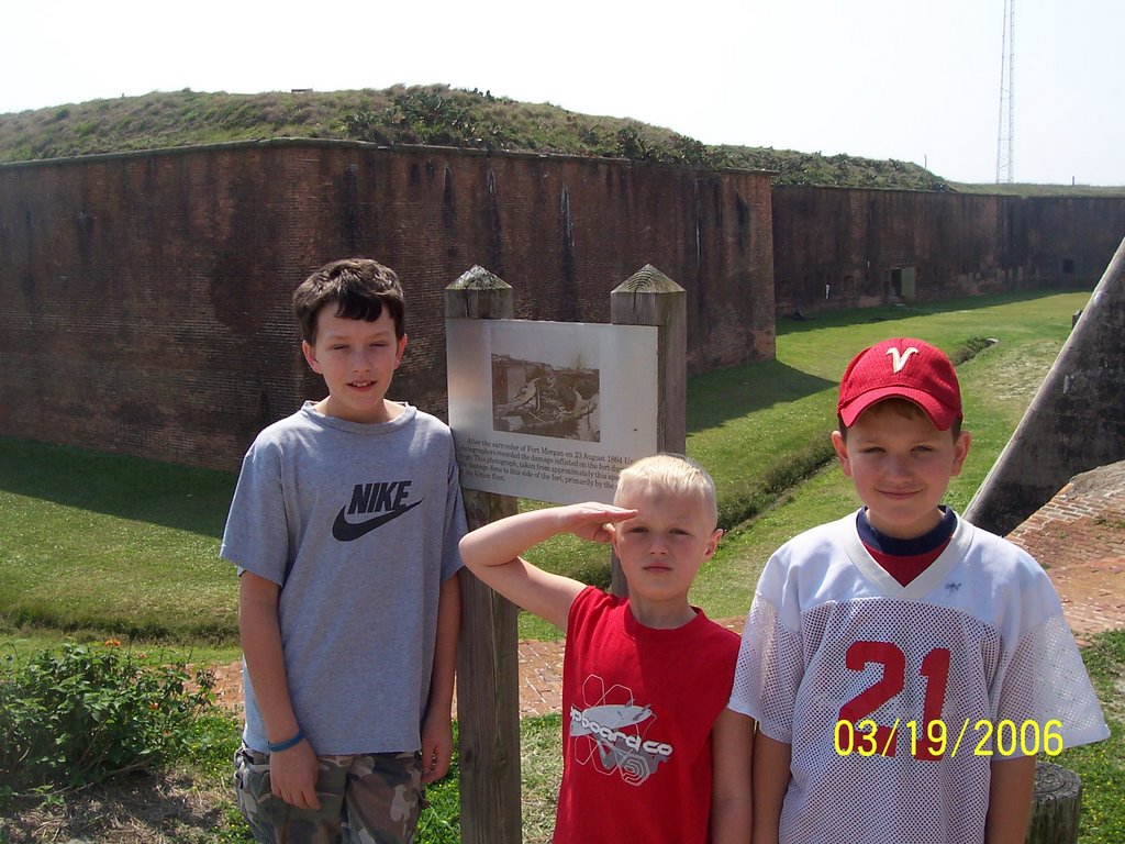
Boys at Fort Morgan

Boys at Fort Morgan

Boys at Fort Morgan
Joe at Fort Morgan

Boys on the Mobile Bay Ferry
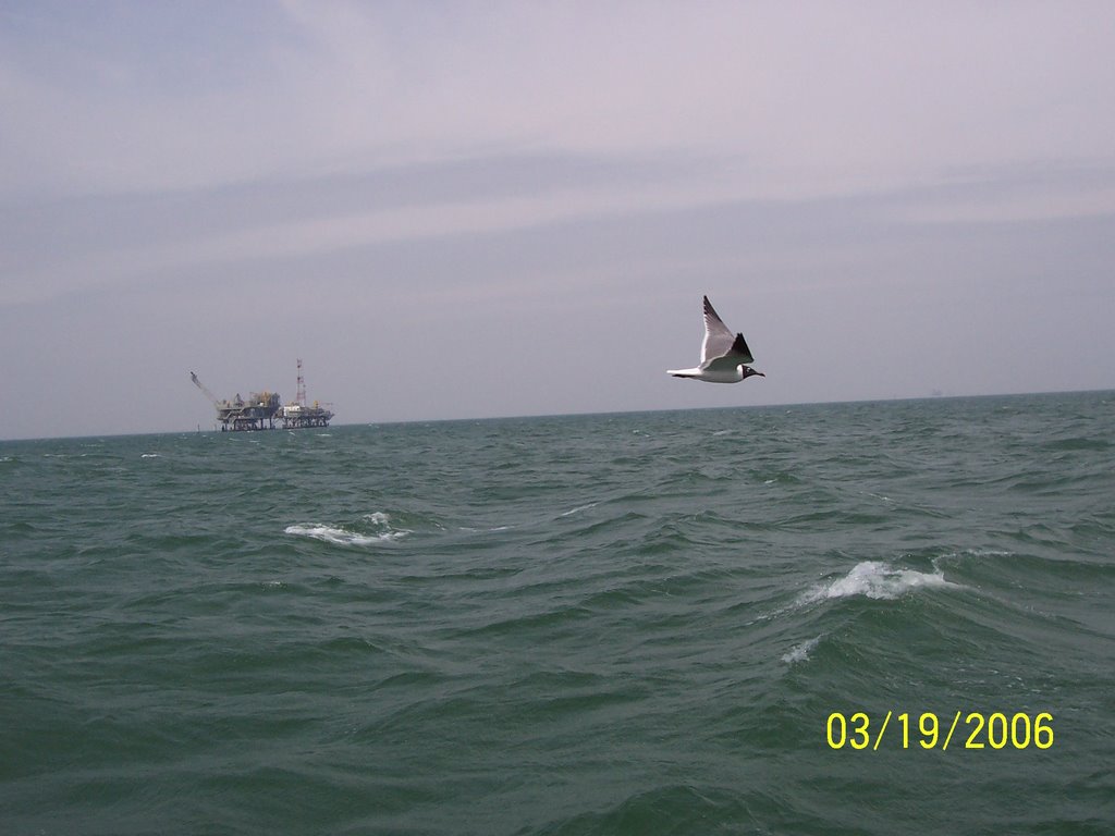
Mobile Bay

Dad and Boys on Mobile Bay ferry
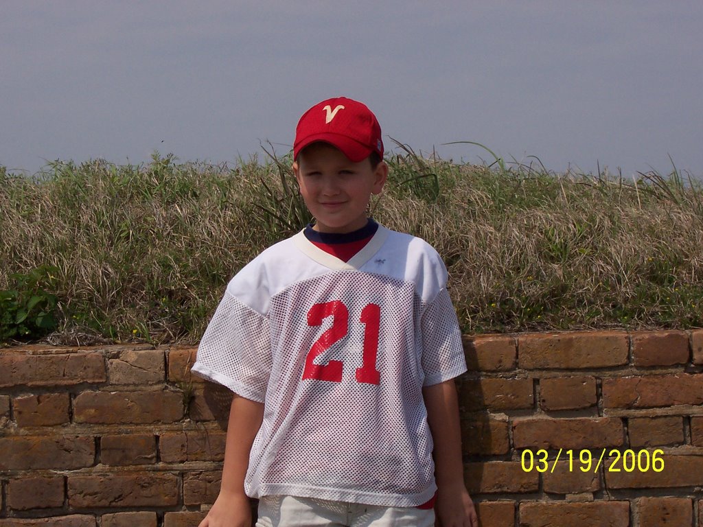
Joe, Matt, and David on Dauphin Island, AL
Boys on West Side of Dauphin Island

Campsite at Gulf State Park
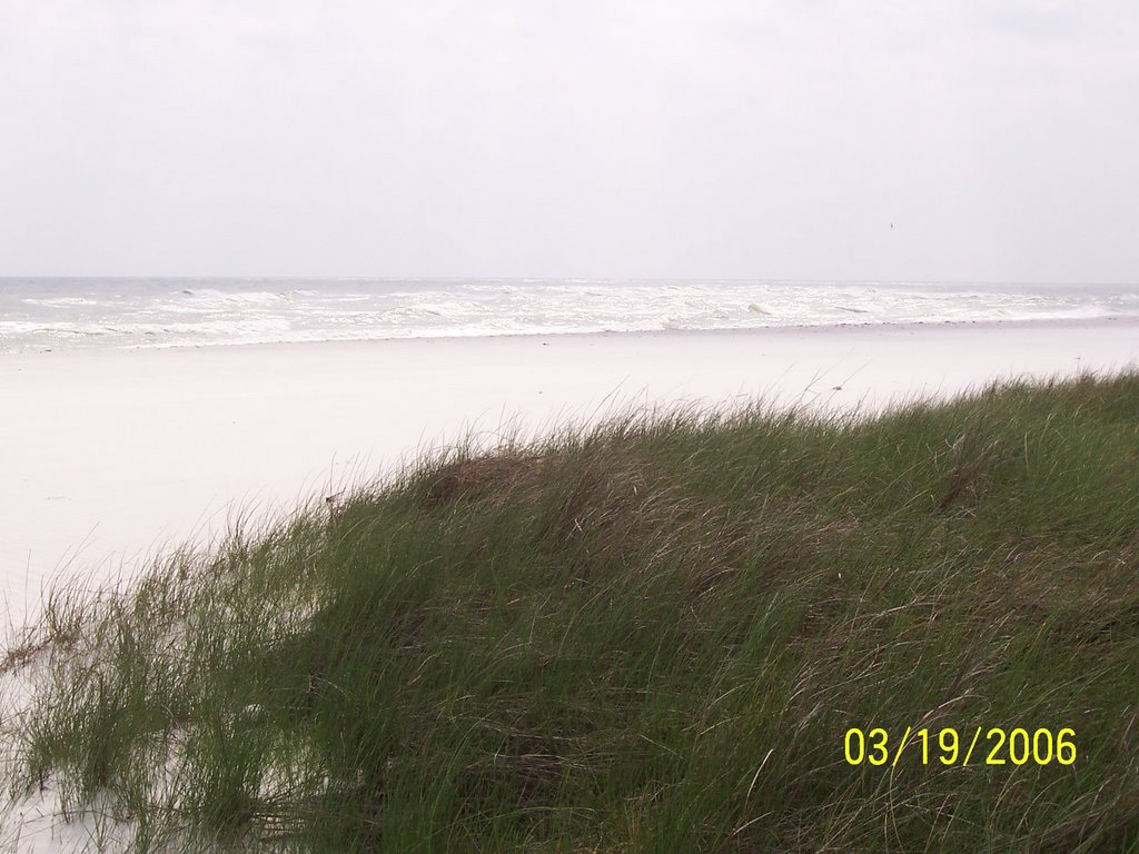
Western Dauphin Island, AL
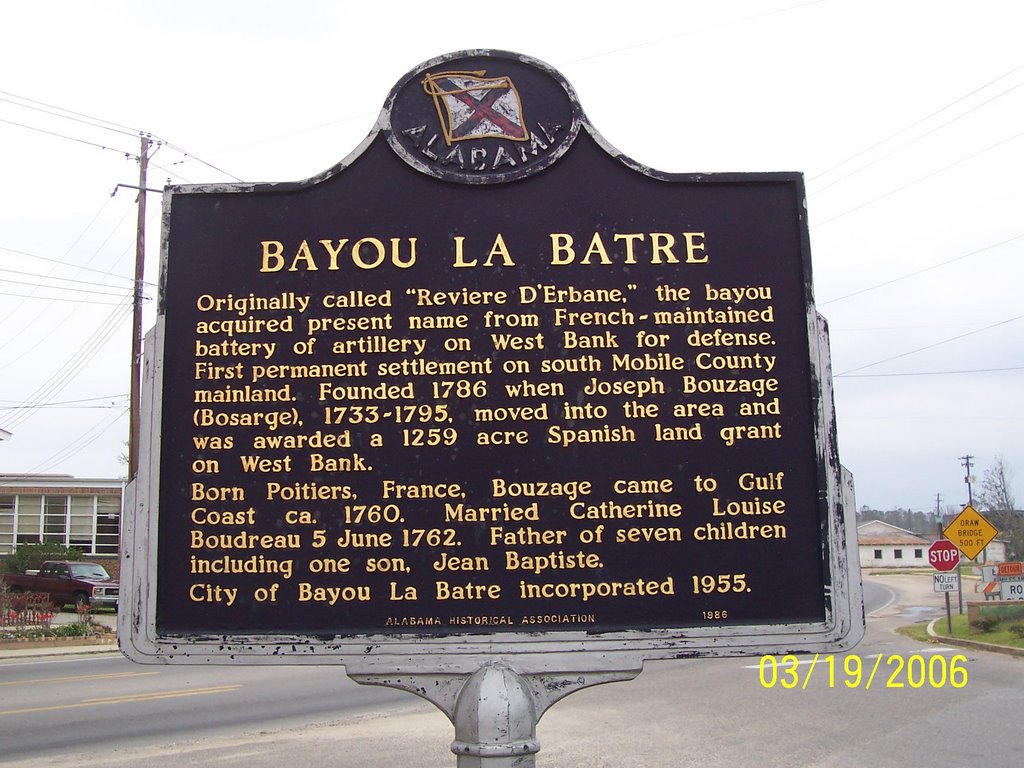
Bayou La Batre, AL

Dauphin Island, Alabama
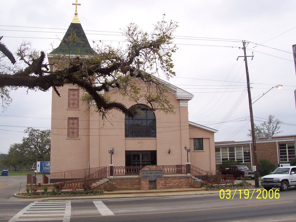
Catholic Church in Bayou La Batre, AL
Thursday, March 23, 2006
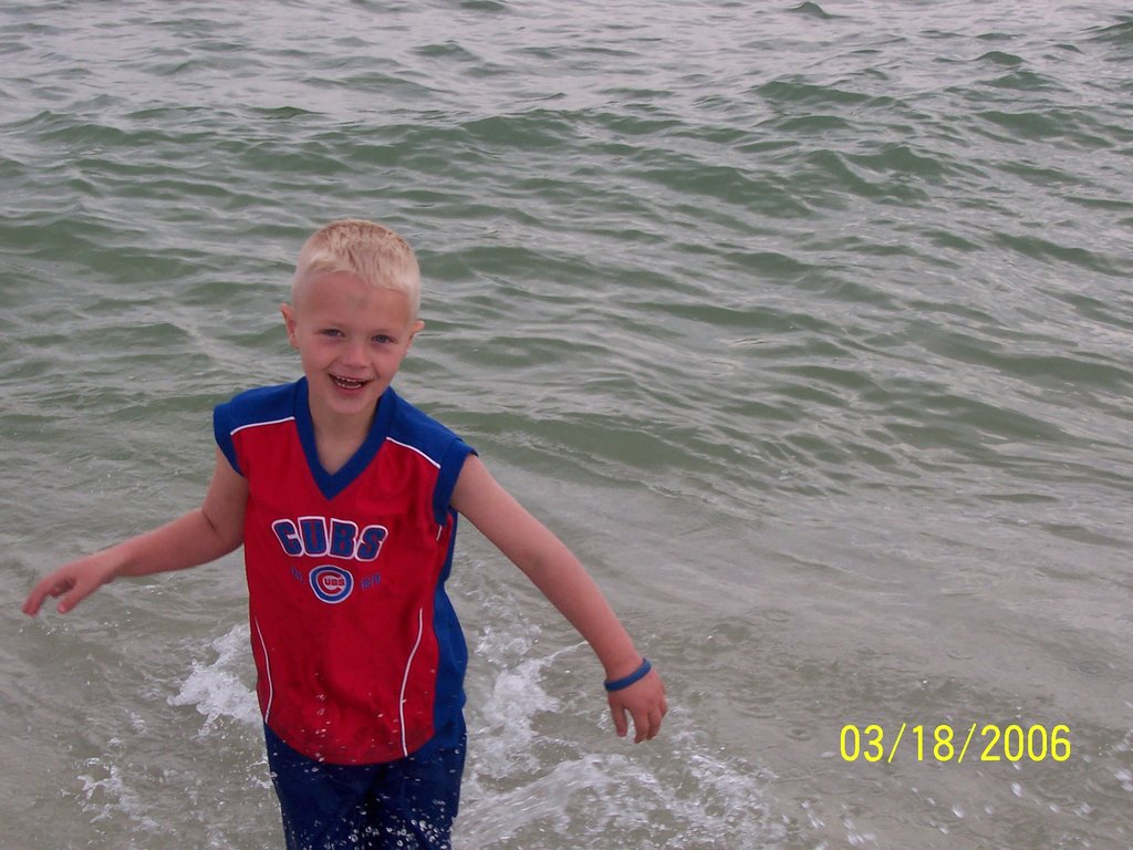
Spring Break Photos 1
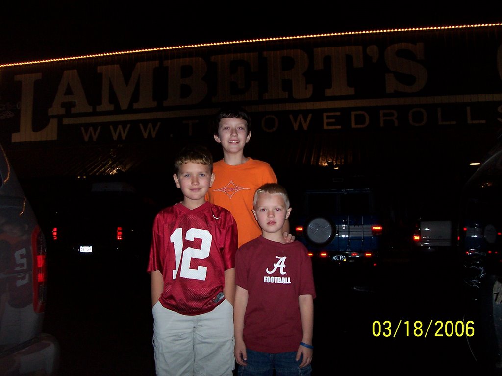
Saturday nigt at Lamberts in Foley!
Lambert's in Foley...Home of the Throwed Rolls
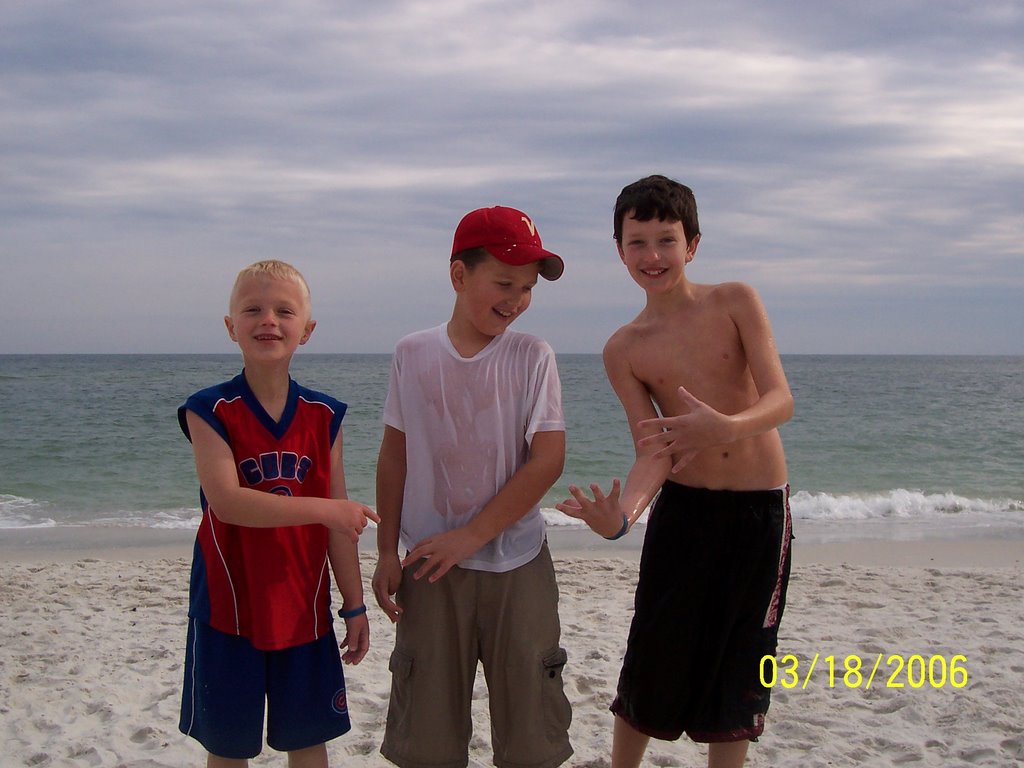
Matt, Joe, and David at Gulf Shores public beach
Joe

Matt
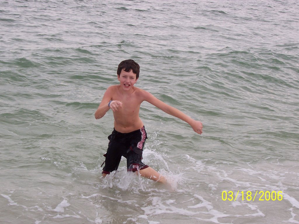
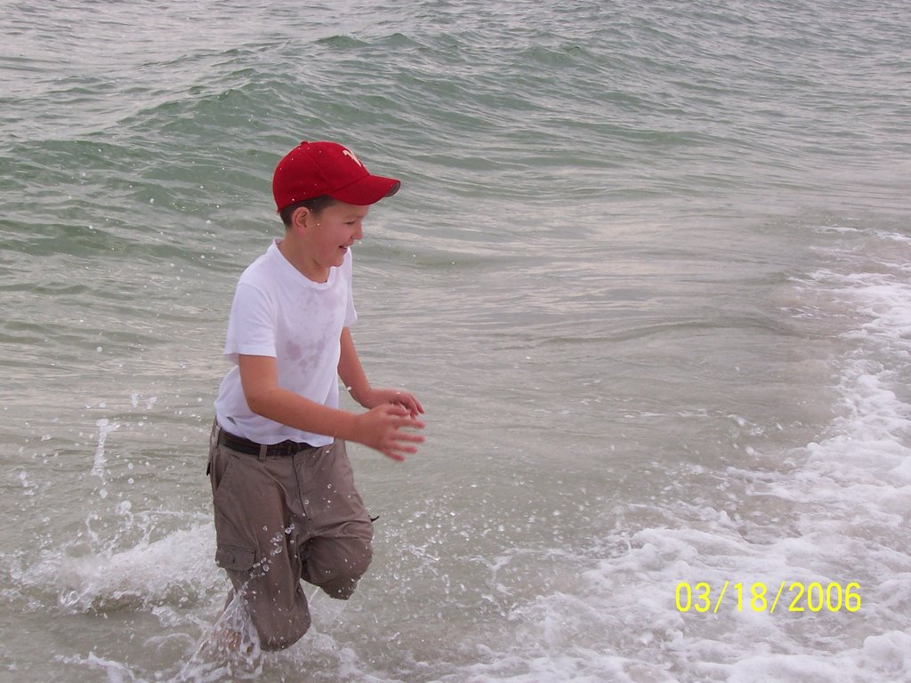
David stayed in that cold water!
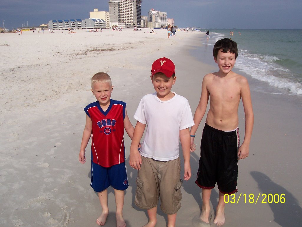
Matt, Joe, David in Gulf Shores, AL
Matthew
Wednesday, March 22, 2006
Spring Break 2006, Part 3
Monday March 20, 2006 was the third and final day of our trip. I got up at 6:30 and organized and cleaned up the car and the campsite before the boys got up around 8:30. They then helped me take down the tent and put up the sleeping bags, dirty clothes, etc. After breakfast we headed to the public beach at the Gulf State Park.
This was the sunniest and warmest day of our trip. While it was in the low to mid 40's across North Alabama, it was 75 in Gulf Shores! It was a red flag day on the beach and the waves were high due to the high winds. The only unpleasant aspect of the beach was that the sand was pelting people pretty hard in the wind. I should have sat down closer to the water so that less sand could hit me.
Regardless, we all had a lot of fun in the sun. The sun was bright and it was easy to get a sunburn in that weather. We had a bit of a sunburn in the areas that we missed with the sunscreen, but for the most part we were ok. We left a little after noon. I stopped at the Winn Dixie and picked up some diet orange Chek Colas (we cannot get those in North Alabama any longer). After Winn Dixie, we ate at McDonalds and started the long trek home at 2:50 p.m.
The driving was easy and comfortable all the way to Montgomery. By the time we got to Montgomery, tornado watches were out and storms were on the horizon. When we went through Montgomery, the temperature was 76. About 10 minutes north of town, it was as if someone turned on the air conditioner. The temperature must have immediately dropped about 20 degrees. We went through a very strong thunderstorm, with cloud to ground lightning, high winds, and torrential rains. It rained the rest of the way home. From Montgomery to Cullman we had to drive between 40 and 60 miles per hour due to the heavy rain and poor visibility. After a quick stop to unload in Cullman County, we travelled on to Huntsville and arrived at exactly 10 p.m. We crashed!
Thank God for a safe and fun Spring Break 2006.
Spring Break 2006, Part 2
On Sunday March 19, 2006 we rose early, ate breakfast, and took off for Fort Morgan. The boys and I really enjoyed our self-guided tour. As we waited on the Mobile Bay Ferry, I fixed a quick lunch in the back of the jeep. We had a great time traveling across the southernmost part of Mobile Bay on the ferry over to Dauphin Island. Not counting the wait, the actual trip across the bay took about 30 minutes.
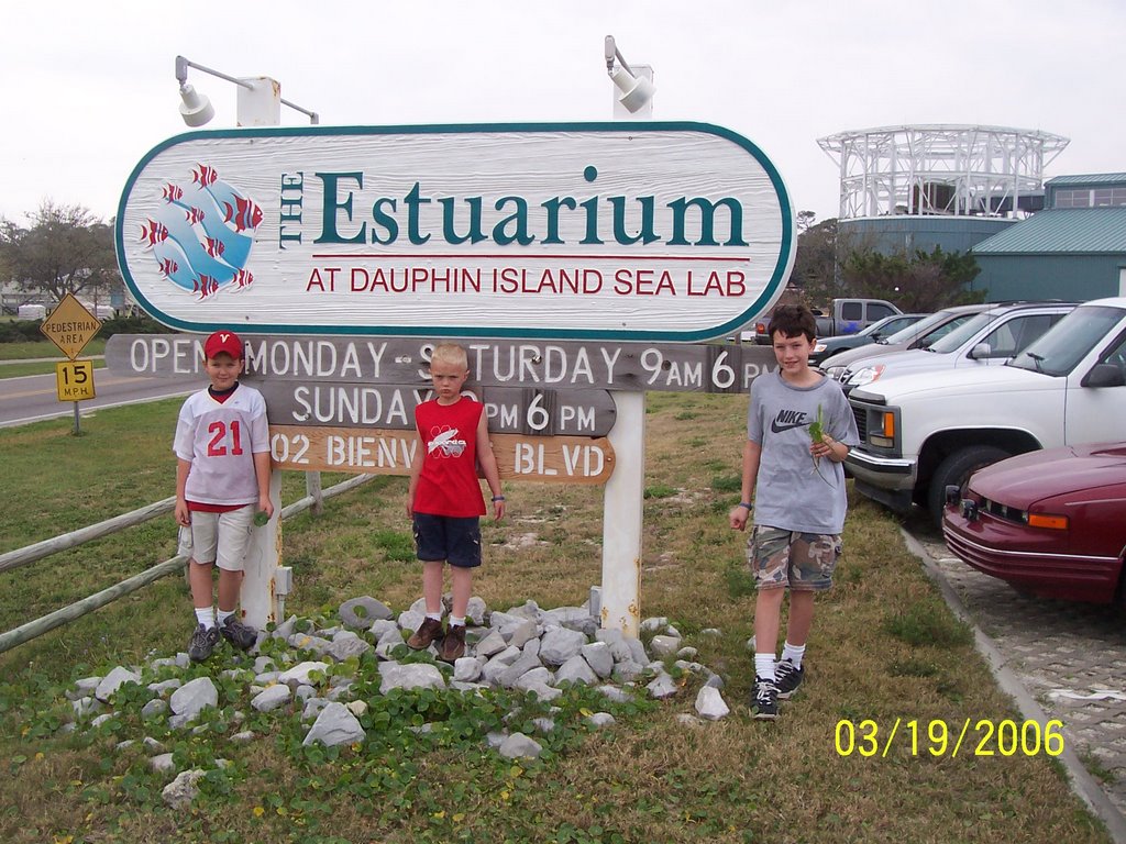
We toured the Esutarium at the Dauphin Island Sea Lab. After that we drove across the island on Bienville Road. We drove over to the western side of the island. There are still numerous beach homes that were damaged or destroyed by Hurrican Ivan in 2004. Some progress has been made as there are a few new homes and a few repaired homes along the route.
We stopped on the western side of Dauphin Island and walked over to the western beach. The sand, sea grass, and environment in general there are simply beautiful. The boys found countless hermit crabs in that area. Sunday's weather was extremely windy out on the island but mostly sunny and temperatures were in the lower 70's. This was much better weather than back home where it was raining most of the day with temperatures in the mid 40's.
After leaving the western beach of Dauphin Island, we had a little time left before needing to get back to the ferry for our return trip to Baldwin County. We drove over the causeway into southern Mobile county, driving through the fishing villages of Coden and Bayou La Batre. The azaleas were in bloom in Baldwin and Mobile counties. The azaleas in these areas were huge and colorful. For some reason the town of Bayou La Batre has always intrigued me. I guess it has to do with the name, the fact it seems so different from my part of Alabama, and the fact it was mentioned in the movie Forrest Gump. We saw a cemetary there named "Oddfellow Cemetary". It may seem odd, but we pulled over there and I took the boys' picture in front of a few beautiful azaleas. According to the boys, two "nosy old ladies" were spying on us.
After visiting the cemetary, we drove back to the ferry boarding area. While we waited for the ferry, we tossed the football around a little while. Again, the ferry ride was really fun. We saw beautiful birds, waves, beaches, the NOAA weather buoy at Dauphin Island, Fort Gaines, Fort Morgan, natural gas rigs, boats, and many other interesting sights.
After arriving back at Fort Morgan, we drove to the campsite, took showers, and went out to eat at Hazel's in Orange Beach. We looked around at a souvenir store, came back to the tent, and watched a video before going to sleep in the tent. More later...
Spring Break 2006
I've been away from the blog now for several days. I took the boys to LA for spring break. Lower Alabama, that is. On Friday March 17, after work, we ate out at Chic Fil A and shopped for food and supplies at Wal Mart. As soon as I got them home, I let them have a "Fear Factor Push Up" for dessert, tucked them in, prayed, and told them a bedtime story. They were asleep by 8 or 8:30. Unfortunately, my work had only begun. I stayed up until almost midnight packing and preparing for our trip.
We woke up at 4:45 a.m. Saturday morning. We left the house at 6:09 and arrived in Gulf Shores at the State Park campground 325 miles later at 11:15 a.m. While we watited to register for our campsite, I made the boys peanut butter and jelly sandwiches and we threw the football. The weather was partly sunny and in the 60's. It took us about an hour to get registered and another hour to pitch our tent and set up our site.
Then it was off to the Gulf Shores public beach area. We were charged $5 to park, which was new to me. I don't remember being charged to park there before. We were on the beach almost all afternoon, though, from 1:15 until 5:45. It was pleasant on the beach but it was a little on the cool side. The skies were mostly cloudy and temperatures were in the upper 60's with brisk winds. The boys got in the water and David stayed in it quite a while. It was just too cold for my 40 year old body. We had a great time and the weather was certainly a lot warmer than it was in North Alabama.
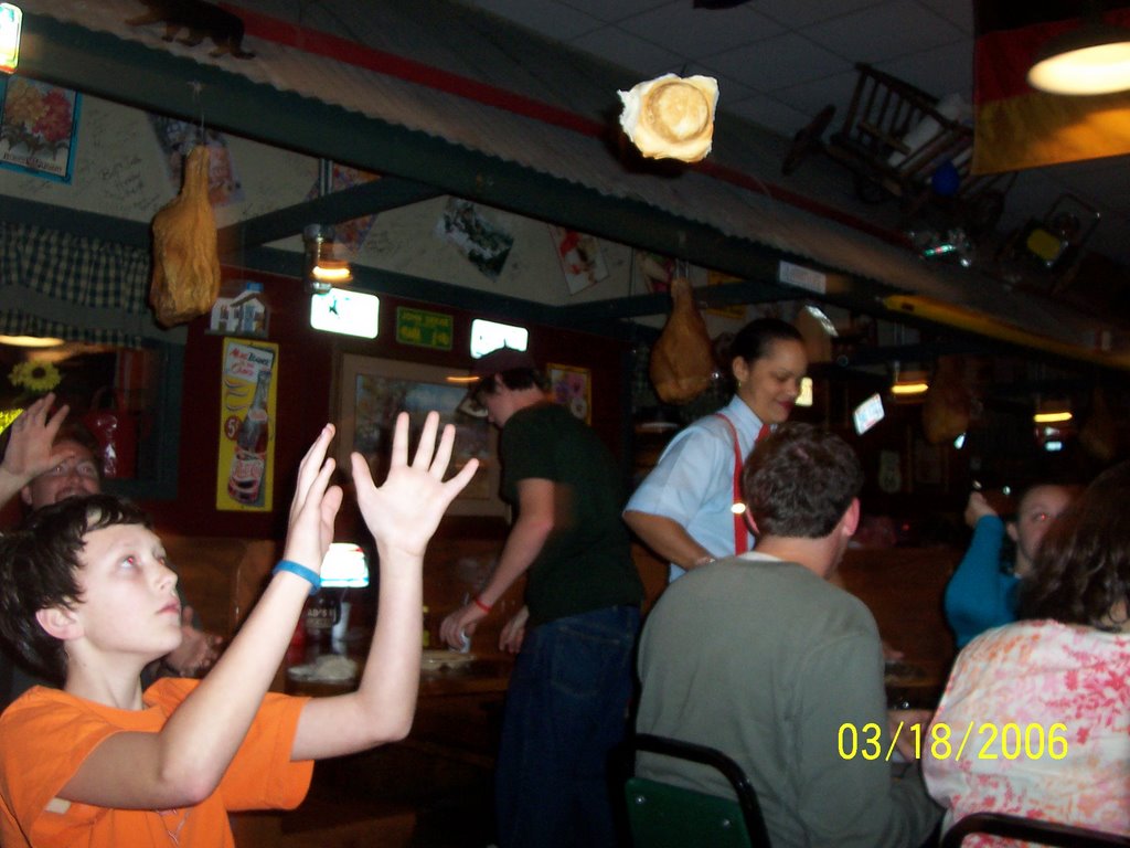
After the beach, we went back to the campsite, took showers in the bath house, and got ready to go out to eat. At the boys' request we ate at Lamberts, home of the 'throwed rolls'. It's always fun to eat there and the food is good. The servings are large and the pass-around vegetables and rolls are always a treat. You also get sorghum molasses or apple butter to go on the rolls. Pass arounds include black-eyed peas, macaroni and tomatoes, fried okra, and my favorite, fried potatoes with onions. The boys each ordered the kid's meal of hamburgers, french fies, and apple sauce. Yes, they made it easy on the waiter! I ordered the fried chicken wings, green beans, and mashed potatoes and gravy. To me the food was great, but we spent $30 real fast there. The kids meals were $5.50 each.
Anyway, we had a great first day of Spring Break on Saturday March 18, 2006. I will post more later.
We woke up at 4:45 a.m. Saturday morning. We left the house at 6:09 and arrived in Gulf Shores at the State Park campground 325 miles later at 11:15 a.m. While we watited to register for our campsite, I made the boys peanut butter and jelly sandwiches and we threw the football. The weather was partly sunny and in the 60's. It took us about an hour to get registered and another hour to pitch our tent and set up our site.
Then it was off to the Gulf Shores public beach area. We were charged $5 to park, which was new to me. I don't remember being charged to park there before. We were on the beach almost all afternoon, though, from 1:15 until 5:45. It was pleasant on the beach but it was a little on the cool side. The skies were mostly cloudy and temperatures were in the upper 60's with brisk winds. The boys got in the water and David stayed in it quite a while. It was just too cold for my 40 year old body. We had a great time and the weather was certainly a lot warmer than it was in North Alabama.
After the beach, we went back to the campsite, took showers in the bath house, and got ready to go out to eat. At the boys' request we ate at Lamberts, home of the 'throwed rolls'. It's always fun to eat there and the food is good. The servings are large and the pass-around vegetables and rolls are always a treat. You also get sorghum molasses or apple butter to go on the rolls. Pass arounds include black-eyed peas, macaroni and tomatoes, fried okra, and my favorite, fried potatoes with onions. The boys each ordered the kid's meal of hamburgers, french fies, and apple sauce. Yes, they made it easy on the waiter! I ordered the fried chicken wings, green beans, and mashed potatoes and gravy. To me the food was great, but we spent $30 real fast there. The kids meals were $5.50 each.
Anyway, we had a great first day of Spring Break on Saturday March 18, 2006. I will post more later.
Thursday, March 16, 2006
More on the Tornadoes of March 13, 2006
On Monday March 13 there were tornadoes in North Alabama. After I left work I drove home, grabbed a bite to eat, picked up my camcorder and digital camera and hit the road. A tornado watch had been issued by the SPC at 2:00 p.m. A lone supercell had been moving eastward across north-central Mississippi and there were some reports of damage and spotter confirmation of a tornado. On my way home from work there was a report of a tornado touchdown in Lamar county at 4:06 p.m. This was spawned by the same supercell that moved across Mississippi.
I decided at this point that this cell would likely hold together a while longer. By my calculations, I could stop by the house, grab my things, and meet the storm near Jasper in Walker County around 5:15. I drove down Alabama Highway 69 into Walker County. Between 5:15 and 5:30 I turned onto Higway 5 and drove west across the northern part of Jasper. By this time the storm was just to the northwest of Jasper, right on schedule.
I was listening to ABC 33/40 meteorologist James Spann on 98.1 FM WTXT out of Tuscaloosa and when WTXT's local broadcasters interrupted James' coverage I listened to Fox 6 Meteorologist David Neal on 87.7 FM. The reports that were coming in sounded like the storm was getting better organized to the northwest of Jasper. Reports also indicated that this was an unusually good chance for there to be enough visibility to actually see the tornado. Most tornadoes in Alabama are wrapped in rain or hidden by the topography.
When I turned west on 5 and drove through the north part of Jasper, I clearly saw a rotating wall cloud, just to the northwest of town. I turned north on Highway 257. Things started getting more interesting. There was a strong inflow into the wall cloud, which contained a ragged funnel, descending at a 45 degree angle. Then I saw several intense cloud to ground lightning strikes approximately one mile to my north. This was at about 5:38. One minute later an F1 tornado touched down 1.5 miles east of Curry and stayed on the ground for about one quarter mile, according to the Birmingham NWS Office. I turned off of 257, hoping to take a shortcut back to 69 north towards Cullman. After going about six miles, trees were crossing the road and the volunteer fire department was attempting to clear the highway. As a result, I had to loop all the way back through Jasper and I didn't get another close look at the storm.
That was a very interesting encounter. I do not reccomend that anyone do something like that without appropriate NWS storm spotter training, a good dose of common sense, and a "safety-first" attitude. I knew where I was in relation to the storm at all times and knew that I was in no danger. I was not able to take any digital pictures, but I did capture some of my experience on video.
See the links below for more information on Monday's storms, including photographs.
Public Information Statement, National Weather Service Birmingham
March 13, 2006 Cullman County Tornado, NWS Huntsville
Previous Mike's Place Blog Entry With Links
"National Weather Service Surveys Storm Damage", Jasper Daily Mountain Eagle
Wednesday, March 15, 2006
Tuesday, March 14, 2006
Yesterday' Storms
Check out the attached links for more information about the storms.
Storm Reports, NWS Birmingham
Photos of tornadoes, funnels, and wall clouds
More storm photos
Monday, March 13, 2006
I'll Admit It, I Cried
I am watching Larry King's interview with Tammy Faye Messmer tonight. She has been in "stage 4" cancer for about 5 years now. To hear her describe her battle, with a true child-like faith, has brought tears to my eyes. She has taken a lot of criticism over the years, but she sounds like a giant in God's eyes! I just wish everyone could see this interview, then you might know what I mean. This is the sincere "rubber-meets-the-road" faith that we all need when we face the end of our days. Actually we all need this faith NOW!
Yes, we will all face death. Lets stop living in denial! We must all be prepared to meet Him on that day. I pray that if you read this you will consider accepting Jesus as the Saviour and the Lord of your life!
"If I should die before I wake, I pray the Lord my soul to keep."
She said that she just needs a hug and someone to tell her everything is going to be o.k., even if it isn't!
God, please please help Tammy powerfully in Jesus name.
Tornadoes in Alabama
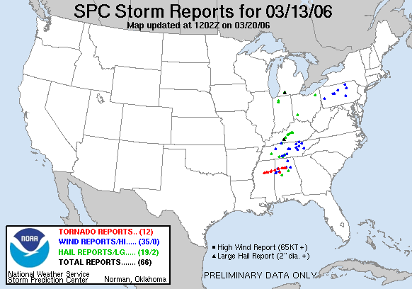
The first tornadoes of 2006 touched down in North Alabama this afternoon and evening. One supercell tracked across Mississippi most of the way through Alabama, causing numerous tornadoes to touch down in Lamar, Fayette, Walker, Cullman, and Blount counties. I do not think any of these were major tornadoes (probably F0-F-1) but they were very photogenic and knocked down numerous trees.
I drove to Jasper and witnessed an amazing wall cloud and funnel just north of town that I caught on video. On my way home i had to turn around due to trees crossing the road.
If I ever figure out a way to do it I will post my video here.
It looks like we might have an active severe weather season in Alabama.
Here are a few interesting links:
Photos from ABC 33/40
Sunday, March 12, 2006
Severe Weather Notes
Reuters Article
Callers to WFMB 104.5 in Springfield, IL report a tornado on the ground at 2 a.m. in the area...
BULLETIN - EAS ACTIVATION REQUESTED TORNADO WARNING NATIONAL WEATHER SERVICE LINCOLN IL 200 AM CST MON MAR 13 2006 THE NATIONAL WEATHER SERVICE IN LINCOLN HAS ISSUED A * TORNADO WARNING FOR... SANGAMON COUNTY IN CENTRAL ILLINOIS * UNTIL 230 AM CST * AT 200 AM CST...NATIONAL WEATHER SERVICE DOPPLER RADAR INDICATED A SEVERE THUNDERSTORM...CAPABLE OF PRODUCING TORNADOES...NEAR LOAMI...OR ABOUT 13 MILES SOUTHWEST OF SPRINGFIELD...MOVING NORTHEAST AT 55 MPH. * LOCATIONS IMPACTED INCLUDE... SPRINGFIELD... ROCHESTER... RIVERTON... DAWSON... BUFFALO... MECHANICSBURG... ILLIOPOLIS... OTHER LOCATIONS IN THE WARNING INCLUDE...CURRAN. WHEN A TORNADO WARNING IS ISSUED BASED ON DOPPLER RADAR...IT MEANS THAT STRONG ROTATION HAS BEEN DETECTED IN THE STORM. THE STORM MAY NOT BE PRODUCING A TORNADO AT THE MOMENT...BUT IS EXPECTED TO DURING THE WARNING PERIOD. FOR YOUR SAFETY...GO INDOORS NOW TO AN INTERIOR ROOM OR A BASEMENT...AND STAY AWAY FROM WINDOWS. REPORT ANY SEVERE WEATHER OR DAMAGE TO YOUR LOCAL EMERGENCY MANAGER...OR THE NEAREST LAW ENFORCEMENT AGENCY...FOR RELAY TO THE NATIONAL WEATHER SERVICE.
BULLETIN - EAS ACTIVATION REQUESTED TORNADO WARNING NATIONAL WEATHER SERVICE SPRINGFIELD MO 1205 AM CST MON MAR 13 2006 THE NATIONAL WEATHER SERVICE IN SPRINGFIELD HAS ISSUED A * TORNADO WARNING FOR... NORTHERN DENT COUNTY IN MISSOURI. * UNTIL 100 AM CST. * AT 1205 AM CST...NATIONAL WEATHER SERVICE DOPPLER RADAR INDICATED A SEVERE THUNDERSTORM CAPABLE OF PRODUCING A TORNADO. THIS DANGEROUS STORM WAS LOCATED 10 MILES SOUTH OF FORT LEONARD WOOD...AND MOVING NORTHEAST AT 55 MPH. * THE TORNADO WILL REMAIN OVER MAINLY RURAL AREAS OF NORTHERN DENT COUNTY...INCLUDING THE TOWNS OF LENOX...ANUTT...LECOMA...LAKE SPRING...HOWES...BANGERT AND SLIGO. THE SAFEST PLACE TO BE DURING A TORNADO IS IN A BASEMENT. GET UNDER A WORKBENCH OR OTHER PIECE OF STURDY FURNITURE. IF NO BASEMENT IS AVAILABLE...SEEK SHELTER ON THE LOWEST FLOOR OF THE BUILDING IN AN INTERIOR HALLWAY OR ROOM SUCH AS A CLOSET. USE BLANKETS OR PILLOWS TO COVER YOUR BODY AND ALWAYS STAY AWAY FROM WINDOWS. IF IN MOBILE HOMES OR VEHICLES...EVACUATE THEM AND GET INSIDE A SUBSTANTIAL SHELTER. IF NO SHELTER IS AVAILABLE...LIE FLAT IN THE NEAREST DITCH OR OTHER LOW SPOT AND COVER YOUR HEAD WITH YOUR HANDS. THIS VERY DANGEROUS STORM HAS A VERY LONG HISTORY OF PRODUCING NUMEROUS TORNADOES...SIGNIFICANT DAMAGE...AND INJURIES. DO NOT TAKE THIS WARNING LIGHTLY...IF YOU LIVE IN NORTHERN DENT COUNTY GET IN YOUR TORNADO SHELTER IMMEDIATELY!!
BULLETIN - EAS ACTIVATION REQUESTED TORNADO WARNING NATIONAL WEATHER SERVICE CHICAGO/ROMEOVILLE IL 1147 PM CST SUN MAR 12 2006 THE NATIONAL WEATHER SERVICE IN ROMEOVILLE HAS ISSUED A * TORNADO WARNING FOR... JASPER COUNTY IN NORTHWEST INDIANA EAST CENTRAL NEWTON COUNTY IN NORTHWEST INDIANA * UNTIL 1230 AM CST * AT 1140 PM CST...A TRAINED SPOTTER REPORTED A BRIEF TORNADO TOUCHDOWN NEAR KENTLAND... AND RADAR INDICATED STRONG ROTATION ASSOCIATED WITH THIS STORM. THE TORNADIC STORM WAS FAIR OAKS TO COLLEGEVILLE TO REMINGTON..MOVING EAST AT 45 MPH. * THE TORNADO PRODUCING STORM IS EXPECTED TO BE NEAR... MOODY BY 1155 PM CST... GIFFORD BY MIDNIGHT CST... THIS STORM HAS HAD A LONG HISTORY OF PRODUCING SIGNIFICANT DAMAGE AS IT MOVED ACROSS ILLINOIS EARLIER THIS EVENING. IF YOU ARE IN THE PATH OF THIS TORNADIC SUPERCELL YOU NEED TO TAKE ACTION NOW TO PROTECT YOUR SELF. MOVE TO AN INTERIOR ROOM ON THE LOWEST LEVEL OF A STRONG STRUCTURE.
BULLETIN - EAS ACTIVATION REQUESTED TORNADO WARNING NATIONAL WEATHER SERVICE SPRINGFIELD MO 1149 PM CST SUN MAR 12 2006 THE NATIONAL WEATHER SERVICE IN SPRINGFIELD HAS ISSUED A * TORNADO WARNING FOR... SOUTHERN PULASKI COUNTY IN MISSOURI. * UNTIL 1245 AM CST. * AT 1147 PM CST...NATIONAL WEATHER SERVICE DOPPLER RADAR WAS TRACKING A TORNADO 15 MILES NORTH OF HARTVILLE...OR 20 MILES SOUTHEAST OF LEBANON. THE TORNADO WAS MOVING NORTHEAST AT 50 MPH. * THE TORNADO WILL BE... NEAR FORT LEONARD WOOD BY 1210 AM CST. THIS STORM HAS A CONFIRMED TORNADO WITH DAMAGE ACROSS NORTHEAST WRIGHT COUNTY.
SEVERE WEATHER STATEMENT NATIONAL WEATHER SERVICE SPRINGFIELD MO 1122 PM CST SUN MAR 12 2006 MOC229-130615- /O.CON.KSGF.TO.W.0042.000000T0000Z-060313T0615Z/ WRIGHT MO- 1122 PM CST SUN MAR 12 2006 ...A TORNADO WARNING REMAINS IN EFFECT FOR WRIGHT COUNTY UNTIL 1215 AM CST... ...THIS IS A TORNADO EMERGENCY FOR RURAL SECTIONS OF WRIGHT COUNTY INCLUDING THE COMMUNITY OF DUNCAN... AT 1121 PM CST...NATIONAL WEATHER SERVICE DOPPLER RADAR AND STORM SPOTTERS WERE TRACKING A LARGE AND EXTREMELY DANGEROUS TORNADO. THE TORNADO WAS LOCATED 9 MILES NORTH OF SEYMOUR...OR 10 MILES SOUTHEAST OF MARSHFIELD...AND MOVING EAST AT 45 MPH. THE TORNADO WILL BE... 6 MILES NORTH OF HARTVILLE BY 1135 PM CST. THE TOWNS OF ODIN...GROVESPRING...MANES AND GRAFF ARE ALSO IN THE PATH OF THIS TORNADO. THIS IS AN EXTREMELY DANGEROUS AND LIFE THREATENING SITUATION. THIS STORM IS CAPABLE OF PRODUCING STRONG TO VIOLENT TORNADOES. IF YOU ARE IN THE PATH OF THIS TORNADO...TAKE COVER IMMEDIATELY!

PRELIMINARY LOCAL STORM REPORT NATIONAL WEATHER SERVICE KANSAS CITY/PLEASANT HILL MO 1100 PM CST SUN MAR 12 2006 ..TIME.. ...EVENT... ...CITY LOCATION... ...LAT.LON... ..DATE.. ....MAG.... ..COUNTY LOCATION...ST.. ...SOURCE.... ..REMARKS.. 0811 PM TORNADO 3 W URICH 38.47N 94.05W 03/12/2006 HENRY MO PUBLIC *** 1 FATAL *** TORNADO WEST OF URICH...SOUTH OF CREIGHTON. 1 FATALITY CONFORMED 3 N URICH...HOUSE DESTOYED. :
PRELIMINARY LOCAL STORM REPORT NATIONAL WEATHER SERVICE SPRINGFIELD MO 1059 PM CST SUN MAR 12 2006 ..TIME... ...EVENT... ...CITY LOCATION... ...LAT.LON... ..DATE... ....MAG.... ..COUNTY LOCATION..ST.. ...SOURCE.... ..REMARKS.. 1056 PM TORNADO FREMONT HILLS 37.07N 93.25W 03/12/2006 CHRISTIAN MO AMATEUR RADIO TORNADO REPORTED ON THE GROUND IN FREMONT HILLS
PRELIMINARY LOCAL STORM REPORT NATIONAL WEATHER SERVICE SPRINGFIELD MO 1052 PM CST SUN MAR 12 2006 ..TIME... ...EVENT... ...CITY LOCATION... ...LAT.LON... ..DATE... ....MAG.... ..COUNTY LOCATION..ST.. ...SOURCE.... ..REMARKS.. 1043 PM TORNADO SPRINGFIELD 37.20N 93.29W 03/12/2006 GREENE MO AMATEUR RADIO POWER FLASHES REPORTED ALONG HIGHWAY 65 AND EVANS ROAD. POSSIBLE TORNADO
SEVERE WEATHER STATEMENT NATIONAL WEATHER SERVICE TULSA OK 1052 PM CST SUN MAR 12 2006 ARC015-130515- /O.CON.KTSA.TO.W.0023.000000T0000Z-060313T0515Z/ CARROLL AR- 1052 PM CST SUN MAR 12 2006 ...A TORNADO WARNING CONTINUES UNTIL 1115 PM CST FOR CARROLL COUNTY... AT 1048 PM CST...WEATHER SERVICE DOPPLER RADAR CONTINUED TO TRACK A DANGEROUS THUNDERSTORM WITH A HISTORY OF PRODUCING TORNADOES. THIS STORM WAS LOCATED 2 MILES SOUTHEAST OF OAK HILL...MOVING EAST NORTHEAST AT 40 MPH. SOME LOCATIONS NEAR THE PATH OF THIS STORM INCLUDE...URBANETTE...OAK GROVE AND DENVER. THIS IS A DANGEROUS STORM WITH A HISTORY OF PRODUCING TORNADOES! IF YOU ARE NEAR THE PATH OF THIS STORM...TAKE COVER NOW! IF NO UNDERGROUND SHELTER IS AVAILABLE MOVE TO AN INTERIOR ROOM ON THE LOWEST FLOOR. MOBILE HOMES AND VEHICLES SHOULD BE ABANDONED FOR MORE SUBSTANTIAL SHELTER. AVOID WINDOWS!
SEVERE WEATHER STATEMENT NATIONAL WEATHER SERVICE TULSA OK 1052 PM CST SUN MAR 12 2006 ARC015-130515- /O.CON.KTSA.TO.W.0023.000000T0000Z-060313T0515Z/ CARROLL AR- 1052 PM CST SUN MAR 12 2006 ...A TORNADO WARNING CONTINUES UNTIL 1115 PM CST FOR CARROLL COUNTY... AT 1048 PM CST...WEATHER SERVICE DOPPLER RADAR CONTINUED TO TRACK A DANGEROUS THUNDERSTORM WITH A HISTORY OF PRODUCING TORNADOES. THIS STORM WAS LOCATED 2 MILES SOUTHEAST OF OAK HILL...MOVING EAST NORTHEAST AT 40 MPH. SOME LOCATIONS NEAR THE PATH OF THIS STORM INCLUDE...URBANETTE...OAK GROVE AND DENVER. THIS IS A DANGEROUS STORM WITH A HISTORY OF PRODUCING TORNADOES! IF YOU ARE NEAR THE PATH OF THIS STORM...TAKE COVER NOW! IF NO UNDERGROUND SHELTER IS AVAILABLE MOVE TO AN INTERIOR ROOM ON THE LOWEST FLOOR. MOBILE HOMES AND VEHICLES SHOULD BE ABANDONED FOR MORE SUBSTANTIAL SHELTER. AVOID WINDOWS!

SEVERE WEATHER STATEMENT NATIONAL WEATHER SERVICE SPRINGFIELD MO 952 PM CST SUN MAR 12 2006 MOC009-109-130430- /O.CON.KSGF.TO.W.0029.000000T0000Z-060313T0430Z/ LAWRENCE MO-BARRY MO- 952 PM CST SUN MAR 12 2006 ...A TORNADO WARNING REMAINS IN EFFECT FOR BARRY AND LAWRENCE COUNTIES UNTIL 1030 PM CST... AT 948 PM CST...TRAINED WEATHER SPOTTERS REPORTED A TORNADO. THE TORNADO WAS LOCATED 5 MILES SOUTHWEST OF PIERCE CITY...OR 7 MILES WEST OF MONETT...AND MOVING EAST AT 60 MPH. THIS STORM HAS A HISTORY OF PRODUCING SIGNIFICANT DAMAGE WITH INJURIES ACROSS NEWTON COUNTY. THE TORNADO WILL BE... NEAR VERONA BY 1000 PM CST. NEAR AURORA BY 1005 PM CST. NEAR MARIONVILLE BY 1010 PM CST. THE TOWNS OF FREISTATT AND PLEASANT RIDGE ARE ALSO IN THE PATH OF THIS TORNADO. THE SAFEST PLACE TO BE DURING A TORNADO IS IN A BASEMENT. GET UNDER A WORKBENCH OR OTHER PIECE OF STURDY FURNITURE. IF NO BASEMENT IS AVAILABLE...SEEK SHELTER ON THE LOWEST FLOOR OF THE BUILDING IN AN INTERIOR HALLWAY OR ROOM SUCH AS A CLOSET. USE BLANKETS OR PILLOWS TO COVER YOUR BODY AND ALWAYS STAY AWAY FROM WINDOWS. IF IN MOBILE HOMES OR VEHICLES...EVACUATE THEM AND GET INSIDE A SUBSTANTIAL SHELTER. IF NO SHELTER IS AVAILABLE...LIE FLAT IN THE NEAREST DITCH OR OTHER LOW SPOT AND COVER YOUR HEAD WITH YOUR HANDS.
---
Numerous damage reports coming in from Springfield, Illinois. The southwest side of town has numerous emergency sirens, there has been damage to Wal-Mart and Target.
Streaming radio coverage on WFMB 104.5 FM, Springfield, IL


0848 PM TORNADO BUFFALO 39.85N 89.41W 03/12/2006 SANGAMON IL EMERGENCY MNGR CONFIRMED TORNADO JUST NORTH OF BUFFALO ON CORNLAND ROAD. Still on the ground east and north of Springfield.
BULLETIN - EAS ACTIVATION REQUESTED TORNADO WARNING NATIONAL WEATHER SERVICE KANSAS CITY/PLEASANT HILL MO 807 PM CST SUN MAR 12 2006 THE NATIONAL WEATHER SERVICE IN PLEASANT HILL HAS ISSUED A * TORNADO WARNING FOR... NORTHEASTERN JOHNSON COUNTY IN WEST CENTRAL MISSOURI NORTHERN PETTIS COUNTY IN CENTRAL MISSOURI NORTHWESTERN COOPER COUNTY IN CENTRAL MISSOURI SOUTHEASTERN LAFAYETTE COUNTY IN WEST CENTRAL MISSOURI SOUTHERN SALINE COUNTY IN CENTRAL MISSOURI * UNTIL 845 PM CST * AT 804 PM CST...TRAINED SPOTTERS ARE TRACKING A LARGE AND EXTREMELY DANGEROUS TORNADO NEAR KNOB NOSTER. DOPPLER IS SHOWING THIS TORNADO MOVING EAST AT 55 MPH. * THE TORNADO WILL BE NEAR... HOUSTONIA BY 815 PM CST. THE TOWNS OF EMMA...NELSON AND BLACKWATER ARE ALSO IN THE PATH OF THIS TORNADIC STORM.

SEVERE WEATHER STATEMENT NATIONAL WEATHER SERVICE KANSAS CITY/PLEASANT HILL MO 803 PM CST SUN MAR 12 2006 MOC101-159-130215- /O.CON.KEAX.TO.W.0027.000000T0000Z-060313T0215Z/ PETTIS MO-JOHNSON MO- 803 PM CST SUN MAR 12 2006 ...A TORNADO WARNING REMAINS IN EFFECT FOR NORTHEASTERN JOHNSON AND NORTHWESTERN PETTIS COUNTIES UNTIL 815 PM CST... AT 759 PM CST...TRAINED WEATHER SPOTTERS REPORTED A HALF MILE WIDE TORNADO. THIS TORNADO WAS LOCATED 3 MILES NORTHWEST OF KNOB NOSTER...MOVING EAST AT 50 MPH. THE TORNADO WILL BE NEAR... HOUSTONIA BY 810 PM CST. THIS IS AN EXTREMELY DANGEROUS AND LIFE THREATENING SITUATION. THIS STORM IS CAPABLE OF PRODUCING STRONG TO VIOLENT TORNADOES. IF YOU ARE IN THE PATH OF THIS TORNADO...TAKE COVER IMMEDIATELY!
PRELIMINARY LOCAL STORM REPORT NATIONAL WEATHER SERVICE ST LOUIS MO 625 PM CST SUN MAR 12 2006 ..TIME... ...EVENT... ...CITY LOCATION... ...LAT.LON... ..DATE... ....MAG.... ..COUNTY LOCATION..ST.. ...SOURCE.... ..REMARKS.. 0520 PM TSTM WND DMG COLUMBIA 38.95N 92.33W 03/12/2006 BOONE MO EMERGENCY MNGR NUMEROUS HOMES DAMAGED IN NORTH CENTRAL PORTIONS OF THE CITY. AT I-70 AND HIGHWAY 740...TRAFFIC LIGHTS ARE GONE. TIME IS ESTIMATED.
AT 444 PM CST...NATIONAL WEATHER SERVICE DOPPLER RADAR AND STORM SPOTTERS WERE TRACKING A LARGE AND EXTREMELY DANGEROUS TORNADO 16 MILES WEST OF JAMESTOWN...MOVING NORTHEAST AT 55 MPH. THIS TORNADO HAS CAUSED SIGNIFICANT DAMAGE IN SEDALIA.

BULLETIN - EAS ACTIVATION REQUESTED TORNADO WARNING NATIONAL WEATHER SERVICE KANSAS CITY/PLEASANT HILL MO 421 PM CST SUN MAR 12 2006 THE NATIONAL WEATHER SERVICE IN PLEASANT HILL HAS ISSUED A * TORNADO WARNING FOR... SOUTHERN COOPER COUNTY IN CENTRAL MISSOURI * UNTIL 500 PM CST * AT 419 PM CST...NATIONAL WEATHER SERVICE DOPPLER RADAR WAS TRACKING A LARGE AND EXTREMELY DANGEROUS TORNADO JUST SOUTH OF SEDALIA. WIDESPREAD DESTRUCTION HAS BEEN REPORTED WITH THIS HALF MILE WIDE TORNADO WHICH REMAINS ON THE GROUND AT THIS TIME. DOPPLER RADAR SHOWED THIS TORNADO RACING NORTHEAST AT 55 MPH. * THE TORNADO WILL BE NEAR... PILOT GROVE AND 6 MILES NORTHWEST OF BUNCETON BY 440 PM CST. THIS IS AN EXTREMELY DANGEROUS AND LIFE THREATENING SITUATION. THIS STORM IS CAPABLE OF PRODUCING STRONG TO VIOLENT TORNADOES. IF YOU ARE IN THE PATH OF THIS TORNADO...TAKE COVER IMMEDIATELY! IN ADDITION TO A TORNADO...EXTREMELY LARGE AND DESTRUCTIVE HAIL UP TO SOFTBALL SIZE IS EXPECTED IN THE PILOT GROVE AREA. THE SAFEST PLACE TO BE DURING A TORNADO IS IN A BASEMENT. GET UNDER A WORKBENCH OR OTHER PIECE OF STURDY FURNITURE. IF NO BASEMENT IS AVAILABLE...SEEK SHELTER ON THE LOWEST FLOOR OF THE BUILDING IN AN INTERIOR HALLWAY OR ROOM SUCH AS A CLOSET. USE BLANKETS OR PILLOWS TO COVER YOUR BODY AND ALWAYS STAY AWAY FROM WINDOWS. IF IN MOBILE HOMES OR VEHICLES...EVACUATE THEM AND GET INSIDE A SUBSTANTIAL SHELTER. IF NO SHELTER IS AVAILABLE...LIE FLAT IN THE NEAREST DITCH OR OTHER LOW SPOT AND COVER YOUR HEAD WITH YOUR HANDS.
 NUMERBULLETIN - EAS ACTIVATION REQUESTED TORNADO WARNING NATIONAL WEATHER SERVICE SPRINGFIELD MO 413 PM CST SUN MAR 12 2006 THE NATIONAL WEATHER SERVICE IN SPRINGFIELD HAS ISSUED A * TORNADO WARNING FOR... EXTREME NORTHERN MORGAN COUNTY IN MISSOURI. * UNTIL 500 PM CST. * AT 409 PM CST...NATIONAL WEATHER SERVICE DOPPLER RADAR WAS TRACKING A CONFIRMED LARGE AND EXTREMELY DANGEROUS TORNADO 6 MILES EAST OF GREEN RIDGE...OR 8 MILES SOUTHWEST OF SEDALIA. DOPPLER RADAR SHOWED THIS TORNADO MOVING NORTHEAST AT 55 MPH. * THE TORNADO WILL REMAIN OVER MAINLY RURAL AREAS OF NORTHWESTERN MORGAN COUNTY. NUMEROUS REPORTS OF EXTENSIVE DAMAGE HAVE BEEN RECEIVED FROM SOUTHERN PETTIS COUNTY. SPOTTERS ARE REPORTING A LARGE ONE HALF MILE WIDE TORNADO ON THE GROUND! THIS IS AN EXTREMELY DANGEROUS AND LIFE THREATENING SITUATION. THIS STORM IS CAPABLE OF PRODUCING STRONG TO VIOLENT TORNADOES. IF YOU ARE IN THE PATH OF THIS TORNADO...TAKE COVER IMMEDIATELY! THIS TORNADO WILL TRACK INTO OR VERY CLOSE TO EXTREME NORTHERN MORGAN COUNTY. IF YOU LIVE IN NORTHERN MORGAN COUNTY IN FLORENCE OR SYRACUSE GET IN YOUR TORNADO SHELTER NOW TO SAVE YOUR LIFE!! OUS REPORTS OF EXTENSIVE DAMAGE HAVE BEEN RECEIVED FROM SOUTHERN PETTIS COUNTY. SPOTTERS ARE REPORTING A LARGE ONE HALF MILE WIDE TORNADO ON THE GROUND! THIS IS AN EXTREMELY DANGEROUS AND LIFE THREATENING SITUATION. THIS STORM IS CAPABLE OF PRODUCING STRONG TO VIOLENT TORNADOES. IF YOU ARE IN THE PATH OF THIS TORNADO...TAKE COVER IMMEDIATELY!


Storms near Kansas City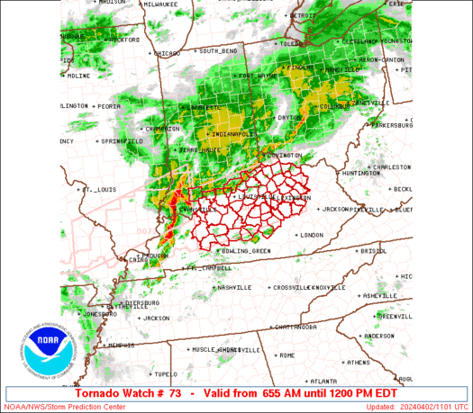
A PDS Tornado watch has been issued for MO and surrounding states.
Callers to WFMB 104.5 in Springfield, IL report a tornado on the ground at 2 a.m. in the area...
BULLETIN - EAS ACTIVATION REQUESTED TORNADO WARNING NATIONAL WEATHER SERVICE LINCOLN IL 200 AM CST MON MAR 13 2006 THE NATIONAL WEATHER SERVICE IN LINCOLN HAS ISSUED A * TORNADO WARNING FOR... SANGAMON COUNTY IN CENTRAL ILLINOIS * UNTIL 230 AM CST * AT 200 AM CST...NATIONAL WEATHER SERVICE DOPPLER RADAR INDICATED A SEVERE THUNDERSTORM...CAPABLE OF PRODUCING TORNADOES...NEAR LOAMI...OR ABOUT 13 MILES SOUTHWEST OF SPRINGFIELD...MOVING NORTHEAST AT 55 MPH. * LOCATIONS IMPACTED INCLUDE... SPRINGFIELD... ROCHESTER... RIVERTON... DAWSON... BUFFALO... MECHANICSBURG... ILLIOPOLIS... OTHER LOCATIONS IN THE WARNING INCLUDE...CURRAN. WHEN A TORNADO WARNING IS ISSUED BASED ON DOPPLER RADAR...IT MEANS THAT STRONG ROTATION HAS BEEN DETECTED IN THE STORM. THE STORM MAY NOT BE PRODUCING A TORNADO AT THE MOMENT...BUT IS EXPECTED TO DURING THE WARNING PERIOD. FOR YOUR SAFETY...GO INDOORS NOW TO AN INTERIOR ROOM OR A BASEMENT...AND STAY AWAY FROM WINDOWS. REPORT ANY SEVERE WEATHER OR DAMAGE TO YOUR LOCAL EMERGENCY MANAGER...OR THE NEAREST LAW ENFORCEMENT AGENCY...FOR RELAY TO THE NATIONAL WEATHER SERVICE.
BULLETIN - EAS ACTIVATION REQUESTED TORNADO WARNING NATIONAL WEATHER SERVICE SPRINGFIELD MO 1205 AM CST MON MAR 13 2006 THE NATIONAL WEATHER SERVICE IN SPRINGFIELD HAS ISSUED A * TORNADO WARNING FOR... NORTHERN DENT COUNTY IN MISSOURI. * UNTIL 100 AM CST. * AT 1205 AM CST...NATIONAL WEATHER SERVICE DOPPLER RADAR INDICATED A SEVERE THUNDERSTORM CAPABLE OF PRODUCING A TORNADO. THIS DANGEROUS STORM WAS LOCATED 10 MILES SOUTH OF FORT LEONARD WOOD...AND MOVING NORTHEAST AT 55 MPH. * THE TORNADO WILL REMAIN OVER MAINLY RURAL AREAS OF NORTHERN DENT COUNTY...INCLUDING THE TOWNS OF LENOX...ANUTT...LECOMA...LAKE SPRING...HOWES...BANGERT AND SLIGO. THE SAFEST PLACE TO BE DURING A TORNADO IS IN A BASEMENT. GET UNDER A WORKBENCH OR OTHER PIECE OF STURDY FURNITURE. IF NO BASEMENT IS AVAILABLE...SEEK SHELTER ON THE LOWEST FLOOR OF THE BUILDING IN AN INTERIOR HALLWAY OR ROOM SUCH AS A CLOSET. USE BLANKETS OR PILLOWS TO COVER YOUR BODY AND ALWAYS STAY AWAY FROM WINDOWS. IF IN MOBILE HOMES OR VEHICLES...EVACUATE THEM AND GET INSIDE A SUBSTANTIAL SHELTER. IF NO SHELTER IS AVAILABLE...LIE FLAT IN THE NEAREST DITCH OR OTHER LOW SPOT AND COVER YOUR HEAD WITH YOUR HANDS. THIS VERY DANGEROUS STORM HAS A VERY LONG HISTORY OF PRODUCING NUMEROUS TORNADOES...SIGNIFICANT DAMAGE...AND INJURIES. DO NOT TAKE THIS WARNING LIGHTLY...IF YOU LIVE IN NORTHERN DENT COUNTY GET IN YOUR TORNADO SHELTER IMMEDIATELY!!
BULLETIN - EAS ACTIVATION REQUESTED TORNADO WARNING NATIONAL WEATHER SERVICE CHICAGO/ROMEOVILLE IL 1147 PM CST SUN MAR 12 2006 THE NATIONAL WEATHER SERVICE IN ROMEOVILLE HAS ISSUED A * TORNADO WARNING FOR... JASPER COUNTY IN NORTHWEST INDIANA EAST CENTRAL NEWTON COUNTY IN NORTHWEST INDIANA * UNTIL 1230 AM CST * AT 1140 PM CST...A TRAINED SPOTTER REPORTED A BRIEF TORNADO TOUCHDOWN NEAR KENTLAND... AND RADAR INDICATED STRONG ROTATION ASSOCIATED WITH THIS STORM. THE TORNADIC STORM WAS FAIR OAKS TO COLLEGEVILLE TO REMINGTON..MOVING EAST AT 45 MPH. * THE TORNADO PRODUCING STORM IS EXPECTED TO BE NEAR... MOODY BY 1155 PM CST... GIFFORD BY MIDNIGHT CST... THIS STORM HAS HAD A LONG HISTORY OF PRODUCING SIGNIFICANT DAMAGE AS IT MOVED ACROSS ILLINOIS EARLIER THIS EVENING. IF YOU ARE IN THE PATH OF THIS TORNADIC SUPERCELL YOU NEED TO TAKE ACTION NOW TO PROTECT YOUR SELF. MOVE TO AN INTERIOR ROOM ON THE LOWEST LEVEL OF A STRONG STRUCTURE.
BULLETIN - EAS ACTIVATION REQUESTED TORNADO WARNING NATIONAL WEATHER SERVICE SPRINGFIELD MO 1149 PM CST SUN MAR 12 2006 THE NATIONAL WEATHER SERVICE IN SPRINGFIELD HAS ISSUED A * TORNADO WARNING FOR... SOUTHERN PULASKI COUNTY IN MISSOURI. * UNTIL 1245 AM CST. * AT 1147 PM CST...NATIONAL WEATHER SERVICE DOPPLER RADAR WAS TRACKING A TORNADO 15 MILES NORTH OF HARTVILLE...OR 20 MILES SOUTHEAST OF LEBANON. THE TORNADO WAS MOVING NORTHEAST AT 50 MPH. * THE TORNADO WILL BE... NEAR FORT LEONARD WOOD BY 1210 AM CST. THIS STORM HAS A CONFIRMED TORNADO WITH DAMAGE ACROSS NORTHEAST WRIGHT COUNTY.
SEVERE WEATHER STATEMENT NATIONAL WEATHER SERVICE SPRINGFIELD MO 1122 PM CST SUN MAR 12 2006 MOC229-130615- /O.CON.KSGF.TO.W.0042.000000T0000Z-060313T0615Z/ WRIGHT MO- 1122 PM CST SUN MAR 12 2006 ...A TORNADO WARNING REMAINS IN EFFECT FOR WRIGHT COUNTY UNTIL 1215 AM CST... ...THIS IS A TORNADO EMERGENCY FOR RURAL SECTIONS OF WRIGHT COUNTY INCLUDING THE COMMUNITY OF DUNCAN... AT 1121 PM CST...NATIONAL WEATHER SERVICE DOPPLER RADAR AND STORM SPOTTERS WERE TRACKING A LARGE AND EXTREMELY DANGEROUS TORNADO. THE TORNADO WAS LOCATED 9 MILES NORTH OF SEYMOUR...OR 10 MILES SOUTHEAST OF MARSHFIELD...AND MOVING EAST AT 45 MPH. THE TORNADO WILL BE... 6 MILES NORTH OF HARTVILLE BY 1135 PM CST. THE TOWNS OF ODIN...GROVESPRING...MANES AND GRAFF ARE ALSO IN THE PATH OF THIS TORNADO. THIS IS AN EXTREMELY DANGEROUS AND LIFE THREATENING SITUATION. THIS STORM IS CAPABLE OF PRODUCING STRONG TO VIOLENT TORNADOES. IF YOU ARE IN THE PATH OF THIS TORNADO...TAKE COVER IMMEDIATELY!
PRELIMINARY LOCAL STORM REPORT NATIONAL WEATHER SERVICE KANSAS CITY/PLEASANT HILL MO 1100 PM CST SUN MAR 12 2006 ..TIME.. ...EVENT... ...CITY LOCATION... ...LAT.LON... ..DATE.. ....MAG.... ..COUNTY LOCATION...ST.. ...SOURCE.... ..REMARKS.. 0811 PM TORNADO 3 W URICH 38.47N 94.05W 03/12/2006 HENRY MO PUBLIC *** 1 FATAL *** TORNADO WEST OF URICH...SOUTH OF CREIGHTON. 1 FATALITY CONFORMED 3 N URICH...HOUSE DESTOYED. :
PRELIMINARY LOCAL STORM REPORT NATIONAL WEATHER SERVICE SPRINGFIELD MO 1059 PM CST SUN MAR 12 2006 ..TIME... ...EVENT... ...CITY LOCATION... ...LAT.LON... ..DATE... ....MAG.... ..COUNTY LOCATION..ST.. ...SOURCE.... ..REMARKS.. 1056 PM TORNADO FREMONT HILLS 37.07N 93.25W 03/12/2006 CHRISTIAN MO AMATEUR RADIO TORNADO REPORTED ON THE GROUND IN FREMONT HILLS
PRELIMINARY LOCAL STORM REPORT NATIONAL WEATHER SERVICE SPRINGFIELD MO 1052 PM CST SUN MAR 12 2006 ..TIME... ...EVENT... ...CITY LOCATION... ...LAT.LON... ..DATE... ....MAG.... ..COUNTY LOCATION..ST.. ...SOURCE.... ..REMARKS.. 1043 PM TORNADO SPRINGFIELD 37.20N 93.29W 03/12/2006 GREENE MO AMATEUR RADIO POWER FLASHES REPORTED ALONG HIGHWAY 65 AND EVANS ROAD. POSSIBLE TORNADO
SEVERE WEATHER STATEMENT NATIONAL WEATHER SERVICE TULSA OK 1052 PM CST SUN MAR 12 2006 ARC015-130515- /O.CON.KTSA.TO.W.0023.000000T0000Z-060313T0515Z/ CARROLL AR- 1052 PM CST SUN MAR 12 2006 ...A TORNADO WARNING CONTINUES UNTIL 1115 PM CST FOR CARROLL COUNTY... AT 1048 PM CST...WEATHER SERVICE DOPPLER RADAR CONTINUED TO TRACK A DANGEROUS THUNDERSTORM WITH A HISTORY OF PRODUCING TORNADOES. THIS STORM WAS LOCATED 2 MILES SOUTHEAST OF OAK HILL...MOVING EAST NORTHEAST AT 40 MPH. SOME LOCATIONS NEAR THE PATH OF THIS STORM INCLUDE...URBANETTE...OAK GROVE AND DENVER. THIS IS A DANGEROUS STORM WITH A HISTORY OF PRODUCING TORNADOES! IF YOU ARE NEAR THE PATH OF THIS STORM...TAKE COVER NOW! IF NO UNDERGROUND SHELTER IS AVAILABLE MOVE TO AN INTERIOR ROOM ON THE LOWEST FLOOR. MOBILE HOMES AND VEHICLES SHOULD BE ABANDONED FOR MORE SUBSTANTIAL SHELTER. AVOID WINDOWS!
SEVERE WEATHER STATEMENT NATIONAL WEATHER SERVICE TULSA OK 1052 PM CST SUN MAR 12 2006 ARC015-130515- /O.CON.KTSA.TO.W.0023.000000T0000Z-060313T0515Z/ CARROLL AR- 1052 PM CST SUN MAR 12 2006 ...A TORNADO WARNING CONTINUES UNTIL 1115 PM CST FOR CARROLL COUNTY... AT 1048 PM CST...WEATHER SERVICE DOPPLER RADAR CONTINUED TO TRACK A DANGEROUS THUNDERSTORM WITH A HISTORY OF PRODUCING TORNADOES. THIS STORM WAS LOCATED 2 MILES SOUTHEAST OF OAK HILL...MOVING EAST NORTHEAST AT 40 MPH. SOME LOCATIONS NEAR THE PATH OF THIS STORM INCLUDE...URBANETTE...OAK GROVE AND DENVER. THIS IS A DANGEROUS STORM WITH A HISTORY OF PRODUCING TORNADOES! IF YOU ARE NEAR THE PATH OF THIS STORM...TAKE COVER NOW! IF NO UNDERGROUND SHELTER IS AVAILABLE MOVE TO AN INTERIOR ROOM ON THE LOWEST FLOOR. MOBILE HOMES AND VEHICLES SHOULD BE ABANDONED FOR MORE SUBSTANTIAL SHELTER. AVOID WINDOWS!
SEVERE WEATHER STATEMENT NATIONAL WEATHER SERVICE SPRINGFIELD MO 952 PM CST SUN MAR 12 2006 MOC009-109-130430- /O.CON.KSGF.TO.W.0029.000000T0000Z-060313T0430Z/ LAWRENCE MO-BARRY MO- 952 PM CST SUN MAR 12 2006 ...A TORNADO WARNING REMAINS IN EFFECT FOR BARRY AND LAWRENCE COUNTIES UNTIL 1030 PM CST... AT 948 PM CST...TRAINED WEATHER SPOTTERS REPORTED A TORNADO. THE TORNADO WAS LOCATED 5 MILES SOUTHWEST OF PIERCE CITY...OR 7 MILES WEST OF MONETT...AND MOVING EAST AT 60 MPH. THIS STORM HAS A HISTORY OF PRODUCING SIGNIFICANT DAMAGE WITH INJURIES ACROSS NEWTON COUNTY. THE TORNADO WILL BE... NEAR VERONA BY 1000 PM CST. NEAR AURORA BY 1005 PM CST. NEAR MARIONVILLE BY 1010 PM CST. THE TOWNS OF FREISTATT AND PLEASANT RIDGE ARE ALSO IN THE PATH OF THIS TORNADO. THE SAFEST PLACE TO BE DURING A TORNADO IS IN A BASEMENT. GET UNDER A WORKBENCH OR OTHER PIECE OF STURDY FURNITURE. IF NO BASEMENT IS AVAILABLE...SEEK SHELTER ON THE LOWEST FLOOR OF THE BUILDING IN AN INTERIOR HALLWAY OR ROOM SUCH AS A CLOSET. USE BLANKETS OR PILLOWS TO COVER YOUR BODY AND ALWAYS STAY AWAY FROM WINDOWS. IF IN MOBILE HOMES OR VEHICLES...EVACUATE THEM AND GET INSIDE A SUBSTANTIAL SHELTER. IF NO SHELTER IS AVAILABLE...LIE FLAT IN THE NEAREST DITCH OR OTHER LOW SPOT AND COVER YOUR HEAD WITH YOUR HANDS.
---
Numerous damage reports coming in from Springfield, Illinois. The southwest side of town has numerous emergency sirens, there has been damage to Wal-Mart and Target.
Streaming radio coverage on WFMB 104.5 FM, Springfield, IL
0848 PM TORNADO BUFFALO 39.85N 89.41W 03/12/2006 SANGAMON IL EMERGENCY MNGR CONFIRMED TORNADO JUST NORTH OF BUFFALO ON CORNLAND ROAD. Still on the ground east and north of Springfield.
BULLETIN - EAS ACTIVATION REQUESTED TORNADO WARNING NATIONAL WEATHER SERVICE KANSAS CITY/PLEASANT HILL MO 807 PM CST SUN MAR 12 2006 THE NATIONAL WEATHER SERVICE IN PLEASANT HILL HAS ISSUED A * TORNADO WARNING FOR... NORTHEASTERN JOHNSON COUNTY IN WEST CENTRAL MISSOURI NORTHERN PETTIS COUNTY IN CENTRAL MISSOURI NORTHWESTERN COOPER COUNTY IN CENTRAL MISSOURI SOUTHEASTERN LAFAYETTE COUNTY IN WEST CENTRAL MISSOURI SOUTHERN SALINE COUNTY IN CENTRAL MISSOURI * UNTIL 845 PM CST * AT 804 PM CST...TRAINED SPOTTERS ARE TRACKING A LARGE AND EXTREMELY DANGEROUS TORNADO NEAR KNOB NOSTER. DOPPLER IS SHOWING THIS TORNADO MOVING EAST AT 55 MPH. * THE TORNADO WILL BE NEAR... HOUSTONIA BY 815 PM CST. THE TOWNS OF EMMA...NELSON AND BLACKWATER ARE ALSO IN THE PATH OF THIS TORNADIC STORM.
SEVERE WEATHER STATEMENT NATIONAL WEATHER SERVICE KANSAS CITY/PLEASANT HILL MO 803 PM CST SUN MAR 12 2006 MOC101-159-130215- /O.CON.KEAX.TO.W.0027.000000T0000Z-060313T0215Z/ PETTIS MO-JOHNSON MO- 803 PM CST SUN MAR 12 2006 ...A TORNADO WARNING REMAINS IN EFFECT FOR NORTHEASTERN JOHNSON AND NORTHWESTERN PETTIS COUNTIES UNTIL 815 PM CST... AT 759 PM CST...TRAINED WEATHER SPOTTERS REPORTED A HALF MILE WIDE TORNADO. THIS TORNADO WAS LOCATED 3 MILES NORTHWEST OF KNOB NOSTER...MOVING EAST AT 50 MPH. THE TORNADO WILL BE NEAR... HOUSTONIA BY 810 PM CST. THIS IS AN EXTREMELY DANGEROUS AND LIFE THREATENING SITUATION. THIS STORM IS CAPABLE OF PRODUCING STRONG TO VIOLENT TORNADOES. IF YOU ARE IN THE PATH OF THIS TORNADO...TAKE COVER IMMEDIATELY!
PRELIMINARY LOCAL STORM REPORT NATIONAL WEATHER SERVICE ST LOUIS MO 625 PM CST SUN MAR 12 2006 ..TIME... ...EVENT... ...CITY LOCATION... ...LAT.LON... ..DATE... ....MAG.... ..COUNTY LOCATION..ST.. ...SOURCE.... ..REMARKS.. 0520 PM TSTM WND DMG COLUMBIA 38.95N 92.33W 03/12/2006 BOONE MO EMERGENCY MNGR NUMEROUS HOMES DAMAGED IN NORTH CENTRAL PORTIONS OF THE CITY. AT I-70 AND HIGHWAY 740...TRAFFIC LIGHTS ARE GONE. TIME IS ESTIMATED.
AT 444 PM CST...NATIONAL WEATHER SERVICE DOPPLER RADAR AND STORM SPOTTERS WERE TRACKING A LARGE AND EXTREMELY DANGEROUS TORNADO 16 MILES WEST OF JAMESTOWN...MOVING NORTHEAST AT 55 MPH. THIS TORNADO HAS CAUSED SIGNIFICANT DAMAGE IN SEDALIA.
BULLETIN - EAS ACTIVATION REQUESTED TORNADO WARNING NATIONAL WEATHER SERVICE KANSAS CITY/PLEASANT HILL MO 421 PM CST SUN MAR 12 2006 THE NATIONAL WEATHER SERVICE IN PLEASANT HILL HAS ISSUED A * TORNADO WARNING FOR... SOUTHERN COOPER COUNTY IN CENTRAL MISSOURI * UNTIL 500 PM CST * AT 419 PM CST...NATIONAL WEATHER SERVICE DOPPLER RADAR WAS TRACKING A LARGE AND EXTREMELY DANGEROUS TORNADO JUST SOUTH OF SEDALIA. WIDESPREAD DESTRUCTION HAS BEEN REPORTED WITH THIS HALF MILE WIDE TORNADO WHICH REMAINS ON THE GROUND AT THIS TIME. DOPPLER RADAR SHOWED THIS TORNADO RACING NORTHEAST AT 55 MPH. * THE TORNADO WILL BE NEAR... PILOT GROVE AND 6 MILES NORTHWEST OF BUNCETON BY 440 PM CST. THIS IS AN EXTREMELY DANGEROUS AND LIFE THREATENING SITUATION. THIS STORM IS CAPABLE OF PRODUCING STRONG TO VIOLENT TORNADOES. IF YOU ARE IN THE PATH OF THIS TORNADO...TAKE COVER IMMEDIATELY! IN ADDITION TO A TORNADO...EXTREMELY LARGE AND DESTRUCTIVE HAIL UP TO SOFTBALL SIZE IS EXPECTED IN THE PILOT GROVE AREA. THE SAFEST PLACE TO BE DURING A TORNADO IS IN A BASEMENT. GET UNDER A WORKBENCH OR OTHER PIECE OF STURDY FURNITURE. IF NO BASEMENT IS AVAILABLE...SEEK SHELTER ON THE LOWEST FLOOR OF THE BUILDING IN AN INTERIOR HALLWAY OR ROOM SUCH AS A CLOSET. USE BLANKETS OR PILLOWS TO COVER YOUR BODY AND ALWAYS STAY AWAY FROM WINDOWS. IF IN MOBILE HOMES OR VEHICLES...EVACUATE THEM AND GET INSIDE A SUBSTANTIAL SHELTER. IF NO SHELTER IS AVAILABLE...LIE FLAT IN THE NEAREST DITCH OR OTHER LOW SPOT AND COVER YOUR HEAD WITH YOUR HANDS.
NUMERBULLETIN - EAS ACTIVATION REQUESTED TORNADO WARNING NATIONAL WEATHER SERVICE SPRINGFIELD MO 413 PM CST SUN MAR 12 2006 THE NATIONAL WEATHER SERVICE IN SPRINGFIELD HAS ISSUED A * TORNADO WARNING FOR... EXTREME NORTHERN MORGAN COUNTY IN MISSOURI. * UNTIL 500 PM CST. * AT 409 PM CST...NATIONAL WEATHER SERVICE DOPPLER RADAR WAS TRACKING A CONFIRMED LARGE AND EXTREMELY DANGEROUS TORNADO 6 MILES EAST OF GREEN RIDGE...OR 8 MILES SOUTHWEST OF SEDALIA. DOPPLER RADAR SHOWED THIS TORNADO MOVING NORTHEAST AT 55 MPH. * THE TORNADO WILL REMAIN OVER MAINLY RURAL AREAS OF NORTHWESTERN MORGAN COUNTY. NUMEROUS REPORTS OF EXTENSIVE DAMAGE HAVE BEEN RECEIVED FROM SOUTHERN PETTIS COUNTY. SPOTTERS ARE REPORTING A LARGE ONE HALF MILE WIDE TORNADO ON THE GROUND! THIS IS AN EXTREMELY DANGEROUS AND LIFE THREATENING SITUATION. THIS STORM IS CAPABLE OF PRODUCING STRONG TO VIOLENT TORNADOES. IF YOU ARE IN THE PATH OF THIS TORNADO...TAKE COVER IMMEDIATELY! THIS TORNADO WILL TRACK INTO OR VERY CLOSE TO EXTREME NORTHERN MORGAN COUNTY. IF YOU LIVE IN NORTHERN MORGAN COUNTY IN FLORENCE OR SYRACUSE GET IN YOUR TORNADO SHELTER NOW TO SAVE YOUR LIFE!! OUS REPORTS OF EXTENSIVE DAMAGE HAVE BEEN RECEIVED FROM SOUTHERN PETTIS COUNTY. SPOTTERS ARE REPORTING A LARGE ONE HALF MILE WIDE TORNADO ON THE GROUND! THIS IS AN EXTREMELY DANGEROUS AND LIFE THREATENING SITUATION. THIS STORM IS CAPABLE OF PRODUCING STRONG TO VIOLENT TORNADOES. IF YOU ARE IN THE PATH OF THIS TORNADO...TAKE COVER IMMEDIATELY!Storms near Kansas City
A PDS Tornado watch has been issued for MO and surrounding states.
High Risk in Missouri, Iowa, and Illinois

The Storm Prediction has issued a "High Risk" today in northern and eastern Missouri, southern Iowa, and northern and western Illinois. They are expecting a major tornado outbreak including powerful long-track tornadoes. A "High Risk" means that the SPC expects at least 20 tornadoes with at least 2 of them rated F3 or higher, or an extreme derecho causing 50 or more widespread wind events with numerous higher end wind (80+ mph) and structural damage reports.
Public Severe Weather Outlook
Big Outbreak of Severe Weather Today?
Talk Weather Forum Thread
Saturday, March 11, 2006
David Said....
The boys say the most interesting things sometimes. David said on Thursday that he likes to be different. He said that's why he likes the Cubs and its why/how he chooses his favorite music. David is a Christian and I hope that his willingness to be 'different' helps him resist peer pressure as he moves into the teen years.
More Severe Weather?
Here is the latest Public Severe Weather Outlook from the Storm Prediction Center.

Another potent storm system is taking aim on the mid-South. The Storm Prediction Center has issued a moderate risk for severe weather for much of Arkansas, Missouri, and surrounding areas. These outlooks are in effect both today and tomorrow.
Another potent storm system is taking aim on the mid-South. The Storm Prediction Center has issued a moderate risk for severe weather for much of Arkansas, Missouri, and surrounding areas. These outlooks are in effect both today and tomorrow.
Friday, March 10, 2006
Storm Reports From Thursday March 9, 2006
Thursday, March 09, 2006
Severe Weather Possible Thursday March 9, 2006
It looks like a serious weather situation is developing over the South this morning. At this point damaging winds are a very real threat and tornadoes are not out of the question, particularly in west Alabama.
Nexlab has a great site with severe weather links.
Nexlab has a great site with severe weather links.
Tuesday, March 07, 2006

Severe Weather Possible Thursday 3/9/06
There is a threat of severe weather over much of the South, including Alabama, on Thursday afternoon and Thursday night.
Storm Prediction Center
ABC 33/40 Weather Blog
Huntsville NWS Discussion
Birmingham NWS Discussion
Memphis NWS Discussion
Jackson, MS NWS Discussion
Storm Prediction Center
ABC 33/40 Weather Blog
Huntsville NWS Discussion
Birmingham NWS Discussion
Memphis NWS Discussion
Jackson, MS NWS Discussion
Monday, March 06, 2006
A Sad Day in Baseball History
Baseball Hall of Famer Kirby Puckett died today at age 44. He was one of the most exciting players of my generation. He played for the Minnesota Twins and my biggest memory of him is how he almost single-handedly defeated my favorite team, the Atlanta Braves, in game 6 of the 1991 World Series.
He had to retire from Major League Baseball prematurely after being hit by a Dennis Martinez pitch in the face and the resulting battle with glaucoma. He eventually went blind in one eye.
The thing I remember most about Kirby is his child-like love of the game. Too bad more of today's players don't have his attitude!
Sunday he had a stroke and never recovered.
God, please bless his family and friends.
http://en.wikipedia.org/wiki/Kirby_Puckett
http://msn.foxsports.com/mlb/story/5387228
Indoctrination
There has been a disturbing trend lately. High school teachers are indoctrinating children with their opinions. Perhaps this has always happened, but it seems more blatent recently. Here's one example.
Thursday, March 02, 2006


Wednesday, March 01, 2006
2005 Memories
Time for a memory or two....

New Year 2005. Just after midnight 1/1/2005, the boys made a memory with Gramma!

Matt's 6th birthday cake, presented by Pawpaw!

The unit I supervise won a 'limo lunch' contest from a local radio station. That was loads of fun for us. We have very few 'perks' with our job, so that was really great fun for us!
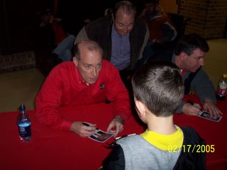
James Spann of ABC 33/40 signs an autograph for Joe during the Storm Alert Tour last February at Wallace state in Hanceville.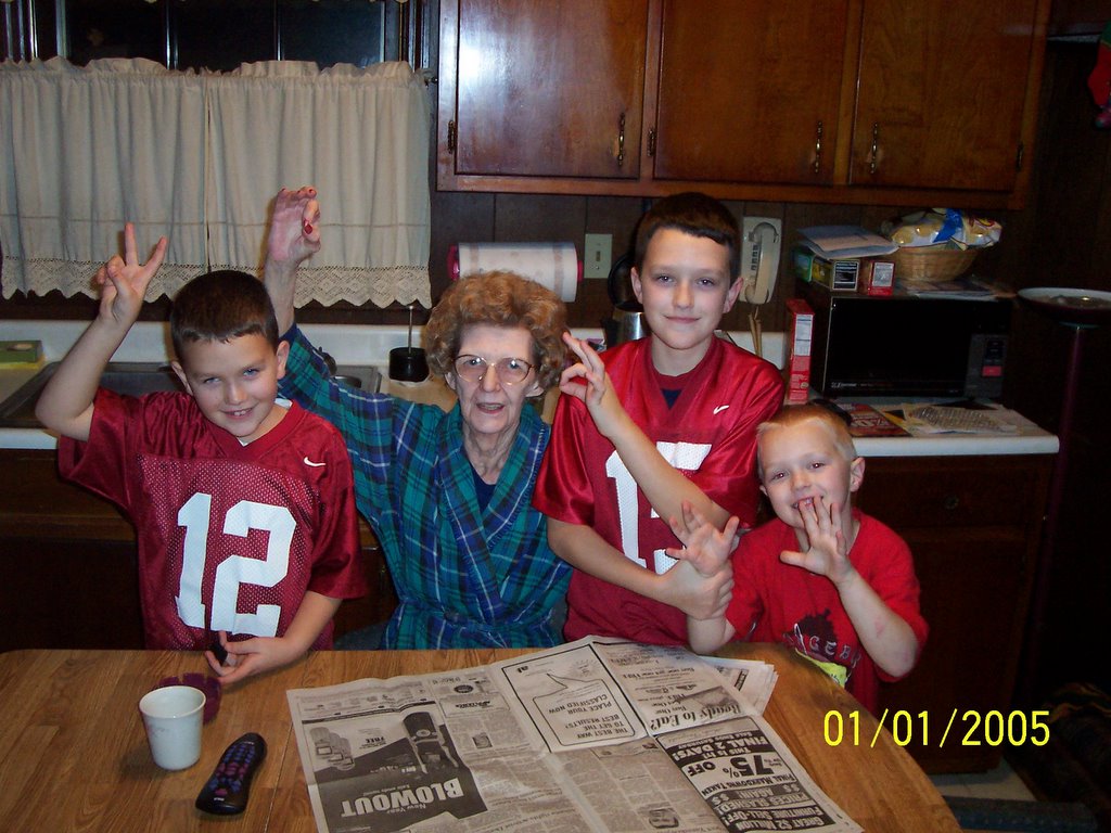
Baseball is Back!
The Braves are back in action. They played their annual first spring training game against the University of Georgia today.
With temperatures in the 70's today, it sure gives me spring fever!
With temperatures in the 70's today, it sure gives me spring fever!
Civil War in Iraq?
I am getting weary of the reporting about Iraq. Certainly, I am no authority. I've never been to the place. However, I've read enough from people who have been there to think that those who keep trying to convince me that there is a full blown civil war probably have an agenda up their sleeve.
Here's another article that flys in the face of the civil war talk:
http://www.nypost.com/postopinion/opedcolumnists/64407.htm
Here's another article that flys in the face of the civil war talk:
http://www.nypost.com/postopinion/opedcolumnists/64407.htm
Subscribe to:
Posts (Atom)
